I have been conducting research regarding lost NER network tile maps, which are basically of three types, and am trying to ascertain whether readers of Heritage Railway are aware of the existence of an updated version of the map in any country house which they have visited or even own.
The updated versions show, among other things, additional railway lines in the Doncaster area of the map, together with the names of stations on these lines, and the names of a cathedral (Wakefield) and an abbey, two castles, six towns/villages, a river and 11 country parks not shown on the original maps.
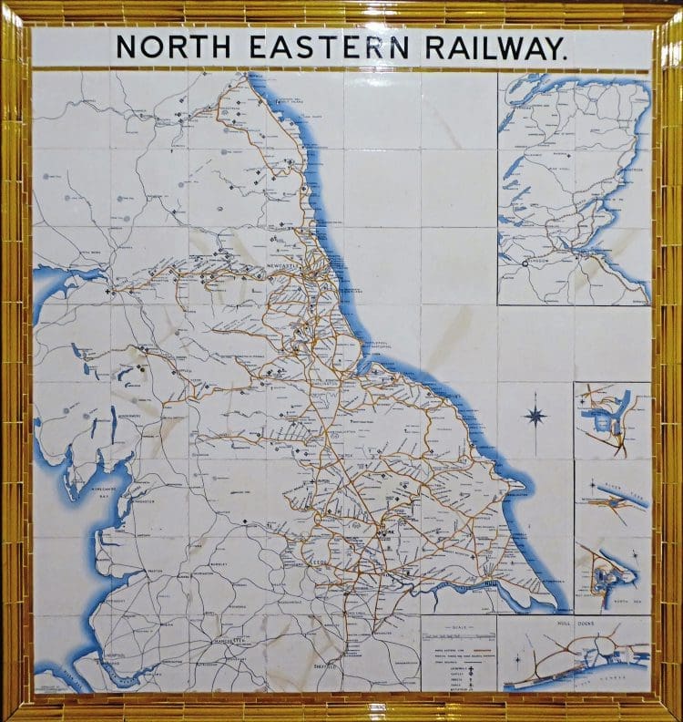
Moreover, they do not show the North Holderness Light Railway, shown on the originals as running north east from Beverley to North Frodingham, but which was never built.
Enjoy more Heritage Railway reading in the four-weekly magazine.
Click here to subscribe & save.
Furthermore, I am trying to find out whether photographs exist showing original maps in position at their original stations from where they have subsequently been removed.
Some I already have, but I cannot find whether any photographs exist for those once displayed at Alnmouth, Bridlington, Darlington, Durham, Goole, Hexham, Hull Paragon, Leeds City South, King’s Cross, Marylebone, Malton, Newcastle Central, Selby and Tyne Dock stations.
Any information sent to the editor or to me at the address shown would be greatly appreciated.
JJ Clarke,
No. 4, RG31 7QB, email
Read more Letters, Opinion, Reviews, News and Views in Issue 251 of HR – on sale now!
Advert
 Enjoy more Heritage Railway reading in the four-weekly magazine. Click here to subscribe.